Introduction to Mt. Rinjani: Indonesia’s Volcanic Treasure
Perched majestically on Lombok Island in Indonesia, Mt. Rinjani stands as a testament to the dynamic geological forces shaping this region. As the second-tallest volcano in Indonesia, Rinjani’s commanding 3,726-meter elevation and active volcanic status make it an irresistible magnet for adventurers, scientists, and nature lovers alike. Its towering presence is intertwined with the cultural, ecological, and economic fabric of West Nusa Tenggara, offering unparalleled opportunities for exploration, scientific study, and eco-tourism. This comprehensive guide aims to present an in-depth exploration of Mt. Rinjani, covering its geological significance, trekking routes, ecological richness, and the cultural tapestry woven into its landscape.
Geographical and Geological Overview
Mount Rinjani is strategically situated within the Gunung Rinjani National Park, an area covering approximately 41,330 hectares that serve as a major ecological transition zone in Indonesia, blending elements from Wallacea and Australasian biogeographical regions. The volcano forms the core of the park and features a complex volcanic system characterized by a caldera, hot springs, a crater lake called Segara Anak, and the active summit vent.
Geologically, Rinjani’s formation dates back around 200,000 years, with its current structure marked by frequent volcanic activity and eruptions. Its stratovolcano composition comprises layers of lava flows, ash deposits, and pyroclastic material, which have contributed to fertile volcanic soils supporting lush biodiversity. The mountain’s rugged terrain offers a diverse landscape of craters, lava domes, and seismic activity, making it a key site for volcanological research.
From a geophysical perspective, Rinjani’s active status is monitored intensively, especially given its history of eruptions and the potential threat it poses to nearby communities. The most recent significant volcanic activity was in October 2015, when ash plumes and lava flows demonstrated its dynamic nature. Understanding these geological processes is vital for disaster preparedness and sustainable tourism development in the region.
Historical Eruptions and Activity
Historical records and geological evidence trace Mount Rinjani’s eruptions over several centuries, with the volcano exhibiting periods of intense activity and quiescence. Its notable eruptions include those in the 19th century, which caused widespread ashfall and ash flows affecting local communities and agriculture.
The eruption in 2015 was particularly significant, lasting for nearly two months and reaching ash plumes of up to 6 km altitude. The eruption was characterized by ash emissions, lava flows, and seismic unrest, prompting the evacuations of nearby villages and the suspension of trekking activities for safety reasons.
Despite these episodes, Rinjani’s eruptions have contributed to its iconic landscape, creating new craters, caldera formations, and fertile volcanic soil. Continuous monitoring by Indonesia’s volcanology agencies helps mitigate risks, offering early warning systems to ensure safety for residents and tourists. The volcano’s activity remains a subject of scientific inquiry, with ongoing research focusing on predicting future eruptions and understanding its magmatic system.
Significance within West Nusa Tenggara
Within the socio-economic landscape of West Nusa Tenggara, Mount Rinjani is more than a natural wonder; it is a cultural emblem and an economic driver. It attracts thousands of trekkers and eco-tourists annually, contributing substantially to local livelihoods and regional development.
The mountain and its surrounding national park are central to local identity, featuring in myths, traditional practices, and rituals among Sasak and Lombok communities. The park’s rich biodiversity and scenic landscapes foster eco-tourism, promoting conservation and sustainable development.
Furthermore, Rinjani’s status as an active volcano necessitates ongoing disaster preparedness initiatives, involving local authorities, scientists, and community groups. As a UNESCO-listed geopark, Rinjani also plays a pivotal role in regional branding and international recognition, positioning Lombok and West Nusa Tenggara as premier eco-destinations.
Planning Your Rinjani Trek: Essential Tips and Preparations
Best Climbing Seasons and Weather Considerations
Timing is critical for a safe and enjoyable trek to Mount Rinjani. The ideal seasons are during the dry months, generally from April to October, when weather conditions favor stable trekking conditions with minimal rain and clearer skies. The months of June, July, and August offer the most stable weather but tend to be busier due to peak tourist season.
During the monsoon season (November to March), heavy rainfall can cause trail erosion, landslides, and increased volcanic activity, posing safety risks. Additionally, cloud cover and fog can significantly reduce visibility, making navigation difficult. Therefore, planning your climb within the dry season enhances safety and allows for better sightseeing and photography opportunities.
Moreover, it’s essential to consider the mountain weather variability, with temperature fluctuations, especially at higher altitudes, requiring proper gear and clothing. Sudden weather changes necessitate flexible planning and mobile communication readiness.
Necessary Equipment and Safety Gear
Preparing appropriately for Mount Rinjani trekking demands comprehensive gear and safety equipment. Essential packing components include:
- Clothing: Warm layers (fleece, insulated jackets), waterproof jackets, moisture-wicking shirts, thermal underwear, hiking pants, and a hat for sun protection.
- Footwear: High-quality, broken-in hiking boots with ankle support and grip suited for rough terrain.
- Camping Supplies: Lightweight tent, sleeping bag rated for low temperatures, camping mat, and stove.
- Navigation and Communication: GPS device, maps, compass, fully charged mobile phone, portable charger, emergency whistle.
- Health and Safety: First aid kit, altitude sickness medication, sunblock, insect repellent, personal medications.
Additional safety gear includes headlamps or torches, gloves, trekking poles, and sunglasses. Due to the mountain’s active volcanic status, a mask or respiratory protection is recommended to shield against ash inhalation during eruptions or heavy ashfalls.
Investing in high-quality gear and ensuring proper preparation significantly reduces risks and enhances comfort during high-altitude ascents.
Permits, Guides, and Park Regulations
To trek Mt. Rinjani legally and responsibly, obtaining the proper permits is mandatory. These are usually arranged through authorized tour operators, local guides, or the park authorities. Permits help fund park conservation and management efforts.
Guides are highly recommended for safety, navigation, and cultural insights. The cost of guides varies but typically ranges around Rp. 350,000 per day, with additional charges for porters and equipment. Hiring local guides supports the community and ensures a more enriching experience.
Park regulations prohibit activities like littering, camping outside designated areas, and disturbing wildlife. Trekkers are advised to follow Leave No Trace principles, respect local customs, and stay on established trails to minimize environmental impact.
It’s crucial to check the latest regulations and obtain permits well in advance, especially during peak seasons, to avoid complications at the entry points.
Hiking Routes and Trails at Mt. Rinjani
Sembalun vs. Senaru Routes: Which Is Right for You?
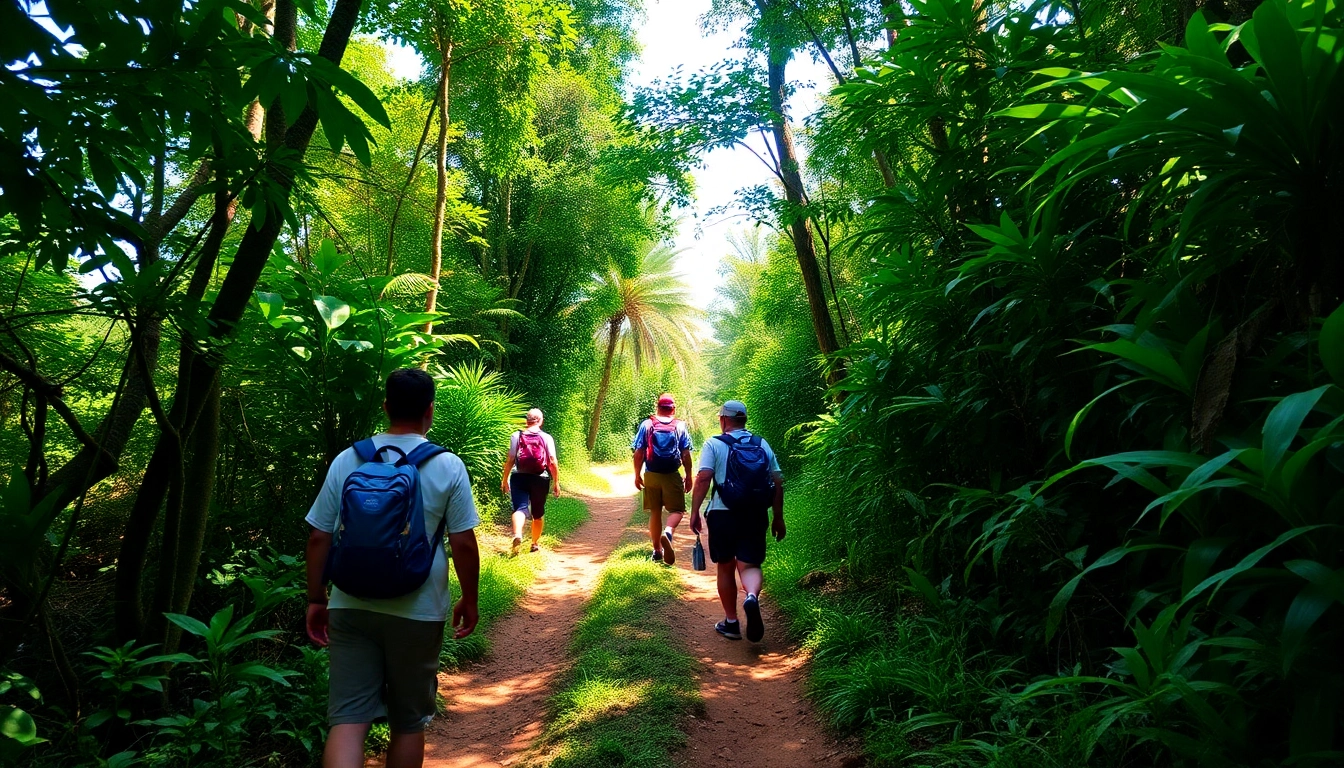
Mount Rinjani offers primarily two trekking routes: the Sembalun and Senaru trails, each with unique features catering to different preferences and experience levels.
Sembalun Route: Starting from the east, this route begins at a higher elevation (around 1,150 meters) and is favored for its relatively gentle ascent, scenic views of the crater lake, and lush landscape. The trail is approximately 27 km long, taking around two days to summit. It offers stunning vistas, volcanic landscape, and opportunities to witness local Sasak culture.
Senaru Route: Originating from the north, this trail starts lower at about 601 meters. Though longer (~37 km), it is more challenging due to steeper sections and dense rainforest, making it suitable for experienced trekkers. The landscape transitions from humid forest to volcanic terrain, providing diverse ecological zones.
Choosing between these routes depends on your fitness level, trekking experience, and desired scenery. Many adventurers opt for a combination of both in a multi-day trek.
Distance, Duration, and Difficulty Levels
Each route presents distinct challenges:
- Sembalun Trail: Distance: ~27 km; Duration: 2-3 days; Difficulty: Moderate. The ascent is gradual, with proper acclimatization, suitable for beginners with some trekking experience.
- Senaru Trail: Distance: ~37 km; Duration: 3-4 days; Difficulty: Hard. The steeper, longer trek demands better physical conditioning and previous trekking experience.
Both routes involve high-altitude walking, with summit temperatures often dropping below freezing. The ascent to the crater rim involves navigating rocky terrain, loose volcanic ash, and sometimes snowy patches, which require careful footing and endurance.
Choosing the appropriate difficulty level ensures a safe and enjoyable experience. Proper acclimatization and physical preparation are essential to prevent altitude sickness and fatigue.
Highlights and Key Landmarks Along the Trails
Several iconic landmarks punctuate the trekking routes:
- Pemantang Sembalun: The starting point for the Sembalun route, known for its scenic mountain views.
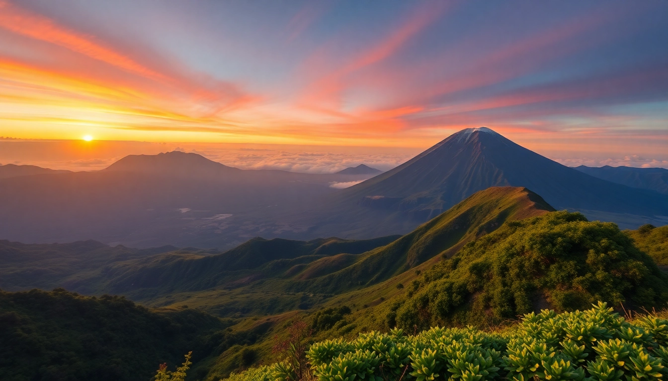
- Crater Rim: Offers breathtaking panoramic views of the Segara Anak Lake and surrounding landscape.
- Segara Anak Lake: A vibrant crater lake nestled within the caldera, accessible via trekking from various points.
- Summit of Rinjani: The highest point of the volcano, offering awe-inspiring vistas of Lombok and beyond.
Along the way, trekkers encounter geothermal hot springs, lush forests, and diverse wildlife, enriching their outdoor experience and providing ample photo opportunities.
Wildlife, Flora, and Eco-Tourism at Mount Rinjani
Unique Flora and Fauna of the National Park
Rinjani’s ecological zones host a remarkable diversity of plant and animal species. The lower elevations are rich with tropical rainforests teeming with orchids, ferns, and endemic trees like the Rinjani holly. As altitude increases, vegetation shifts to alpine grasses and mosses.
Prominent fauna includes the endangered Lombok primate (Presbytis lombokensis), hornbills, eagles, civets, and various species of butterflies. The park also serves as a habitat for several rare orchids and medicinal plants used by local communities.
Conservation Efforts and Sustainable Tourism
Preserving Rinjani’s ecological integrity is a priority for local and national authorities. Initiatives include reforestation projects, waste management programs, and community-based conservation projects involving indigenous groups.
Eco-tourism strategies emphasize minimizing environmental impacts through regulated trekking permits, waste disposal policies, and visitor education. Several eco-lodges and guides promote sustainable tourism, ensuring local communities benefit economically while conserving the environment.
Partnerships with international organizations support continuous research and the development of eco-friendly infrastructure, including renewable energy systems and low-impact camping facilities.
Community Involvement and Local Culture
The local Sasak and Lombok populations are integral to Rinjani’s cultural landscape. Their traditional practices, including offerings to mountain spirits and participation in rituals, are often intertwined with trekking activities, adding a spiritual dimension to the experience.
Community-based tourism initiatives empower local villages, offering homestays, cultural performances, and craft markets. These activities promote cultural exchange, preserve local traditions, and generate sustainable income for residents.
Post-Trek Experiences and Attractions Around Lombok
Top Cultural and Natural Spots Nearby
After conquering Rinjani, visitors can explore Lombok’s diverse attractions. The Gili Islands—Gili Trawangan, Gili Air, and Gili Meno—are renowned for their turquoise waters, snorkeling, and vibrant nightlife. The Senggigi Beach area offers pristine beaches for relaxation.
Must-visit sites include the traditional Sasak villages of Sembalun and Sukarara, the historic Pura Lingsar Temple, and the Sendang Gile and Tiu Kelep Waterfalls in Senaru valley.
Local Cuisine and Hospitality
Lombok’s culinary scene is a blend of spicy, aromatic flavors rooted in indigenous traditions. Specialties include Ayam Taliwang (spicy grilled chicken), Plecing Kangkung (water spinach salad with chili and shrimp paste), and Sate Rembiga (spiced skewered beef). Local warungs and cafes provide authentic dining experiences.
Hospitality is warm and welcoming, with homestay options offering cultural immersion. Visitors are encouraged to engage with local communities for an authentic and respectful experience.
Additional Adventure Activities in Lombok
Beyond trekking, Lombok offers surfing at Kuta Beach, diving and snorkeling at Gili Islands, paragliding from the hilltops, and exploring surfing villages with traditional Sasak architecture. Adventure enthusiasts can also try mountain biking, cave exploring, and fishing expeditions.
These activities allow travelers to diversify their itinerary and enjoy Lombok’s natural beauty while supporting local economies.